
How are drones being used to map glaciers?
Learn how climate scientists are using drones to monitor glaciers and plan for changing water resources.
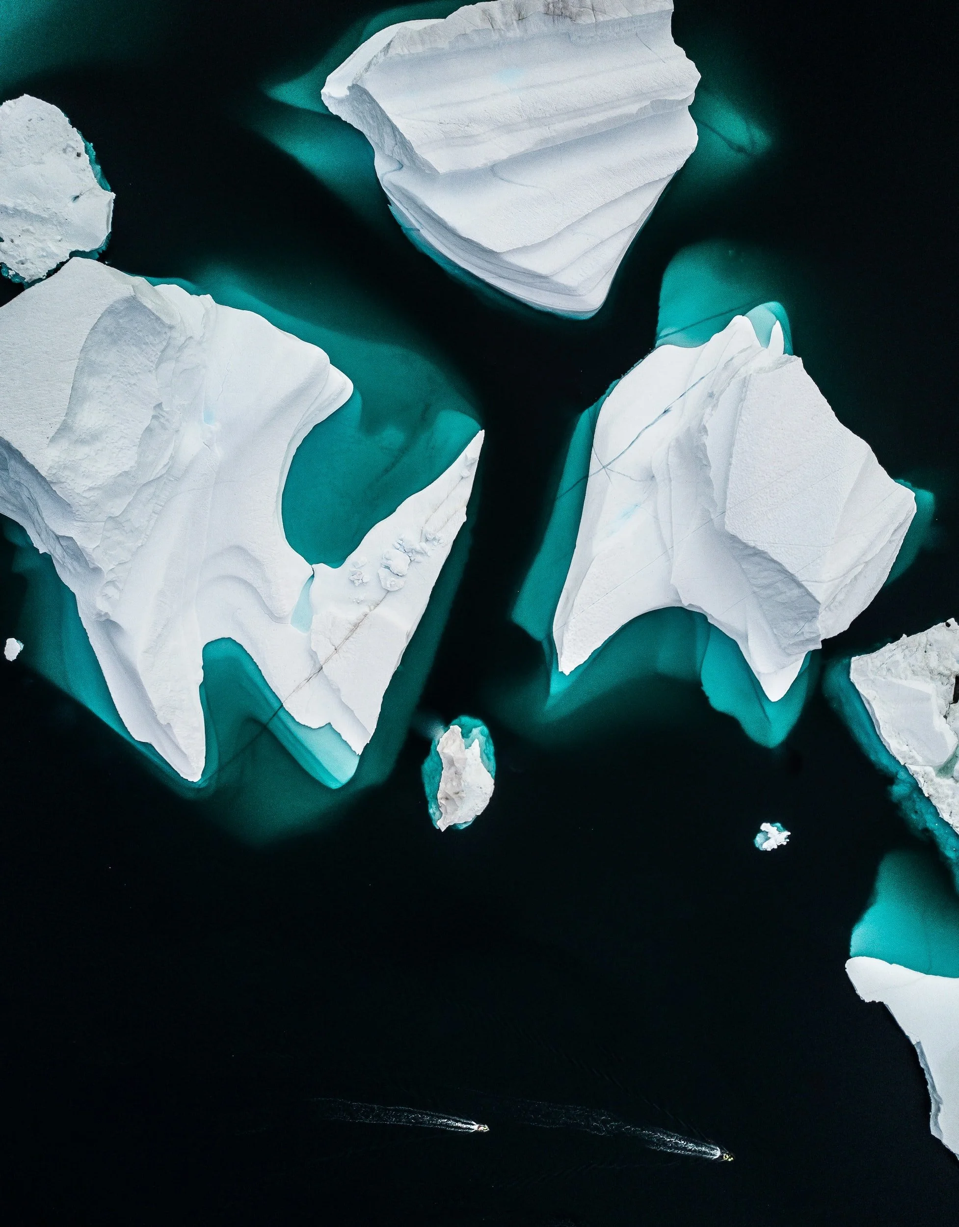
Image courtesy of annie spratt
The world’s melting glaciers are a powerful and tangible representation of climate change. We’ve watched bodies of ice melt for decades and have used glacial melt to advocate for climate reform. In addition to being an emblematic symbol of climate change, there are a number of other reasons that scientifically mapping and analyzing the extent of glaciers and ice sheets is important.
Ice sheet meltwater contributes to sea level rise that endangers coastal communities all around the globe. Additionally, over one billion people rely on glacier-fed water for drinking, washing, farming, or hydropower, and glacial melt threatens these populations’ water supply.
However, there are gaps in our understanding of how ice sheets melt. There are many factors influencing this process, and some of these factors create self-reinforcing feedback to the system. For instance, ice melt can cause algae to grow on the surface of an ice sheet, which darkens the ice so that it can absorb more light from the sun, further accelerating continued melt.
Drones are a powerful tool to map ice sheets as they capture higher resolution images than satellites but can cover much larger expanses of land than ground measurements. Drone measurements also inform models that use AI to classify land surface types in satellite imagery and measure ice sheet area. They can even fly sensors that collect data to measure ice albedo or reflectivity, which can help scientists create energy balance models.
“Drones are a powerful tool to map ice sheets as they capture higher resolution images than satellites but can cover much larger expanses of land than ground measurements.”
Drone glacier mapping is especially helpful at the planet’s poles, where the only two ice sheets on Earth are located. Considering the Greenland ice sheet is the size of Mexico, drones allow researchers to more efficiently cover large areas than manual data collect. In addition to collecting raw data, drones can also collect photos and videos for educational content and public outreach, as demonstrated by the public outreach video “Ice Alive.”

more than one billion people rely on glacier-fed water for drinking, washing, farming, and hydropower
Why is drone glacier mapping important?
Glacier mapping is more than a way to examine ice dynamics and behavior. Understanding how glaciers contribute to our global climate and how they are impacted by climate change is crucial to our ability to adapt and respond to the climate crisis. Still, for some communities, glaciers provide a way of life.
One such place is along the border of Kyrgyzstan and Tajikistan, where glaciers provide rural communities with the water necessary to grow crops for export, support livestock, generate hydropower, and supply residents with drinking water. However, in recent years, the glaciers have retreated due to increased annual temperatures caused by climate change.
In 2017 and 2018, a Finnish-sponsored project collaborated with the Hydrometeorological Agencies of Kyrgyzstan and Tajikistan to monitor their national glaciers. Over three days, the crew flew over twenty missions on the Turgen-Aksu glacier in Kyrgyzstan, successfully mapping 39% of the 6 km2 glacier. The Tajik team faced worse weather conditions but still collected 1,500 images of the GGP glacier.
Understanding the dynamics of glacier melt will help prepare both nations to plan for changing water resources. Additionally, the mapping missions involved skill transfer whereby the Finnish researchers trained Tajik and Kyrgyz colleagues to fly drones and process the data independently so that the project can continue for the years to come.
Drone glacier mapping is especially helpful at the planet’s poles, where the only two ice sheets on Earth are located
What are some of the challenges of drone glacier mapping?
Like all drone projects, drone climate research work encounters the typical challenges involving permitting, privacy and safety considerations, wildlife impact, and local community support. However, in remote and cold environments, such as the ones encountered doing glacier research, drone pilots can face a very different set of challenges. Harsh weather can affect drones in several ways, from shattering plastic rotors that get brittle in the cold to icing that affects drones’ ability to fly.
The cold affects pilots too, and gloves can make using flight controls more difficult. On the ground, researchers in arctic environments have to be careful with gravel runways that can kick back rocks into instruments, and they themselves may have to guard against threats from wildlife such as polar bears.
Often, flight plans must be adjusted to accommodate the cold and remoteness, as researchers have to plan for shorter flights with no access to an internet connection, downloading waypoints and updating firmware before leaving home. Fortunately, technology has improved to support some solutions, from experimental de-icing coatings to self-heating batteries that can support flights in the cold.
Stay up to date
Join our bi-weekly newsletter to receive updates about the latest developments and opportunities in the drones for climate research space.
Start your own climate research project
Book a call with our team to chat about how we can help design and implement your own climate research project.